PCT WEEK 4 – Mice and Men

Two weeks ago feels like a lifetime ago. Time doesn’t seem to work the same way when you’re on trail. I’m usually able to keep track of what day of the week it is, but the days feel like weeks, and the weeks feel like months. I’m typically on my feet from 7am to 6pm, with a few breaks here and there. Every footstep and every breath is intentional and I’ve got little to distract me from my thoughts throughout the day, so the days never really “slip away” like they do back home when I’m working or in my house. For that reason, every day, every hour, every minute, and every second has that much more meaning and weight.

Two weeks ago, I was at mile marker 318. I had just made the decision to leave the group I had been hiking with for the previous week and a half or so. I was out on my own again and had set my mind on staying solo and taking the time to “soak it all in” and spend a bit more time and thought on the scenery and life along the trail. As much as I enjoy hiking with good company, I also find it distracting. It’s easy to get lost in conversation and to lose focus on the world around you when other humans are present. Conversations quickly shift away from the present and into the past and the future and suddenly you’re not even in the wilderness anymore. Your body is on autopilot and your mind is a million miles away – something I’d really like to avoid when “nature soaking.”

One of my earlier trail friends had once said “I’m not out here to tour every gas station in Southern California” and that really stuck with me. I often need to remind myself to redirect my attention from how far I am from the next town or resupply and to focus instead on the trail in front of me and all the beauty presented by its surrounding scenery and wildlife. I’ve honestly found it a lot easier to do this now that I’m (mostly) on my own again. When hiking with a partner, or in a group, it’s easy to get carried away in the what/when/where/how. We’ll spend the day discussing where we’re going, how long it will take, and what we’re going to do when we get there.

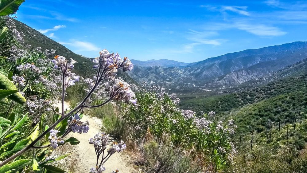
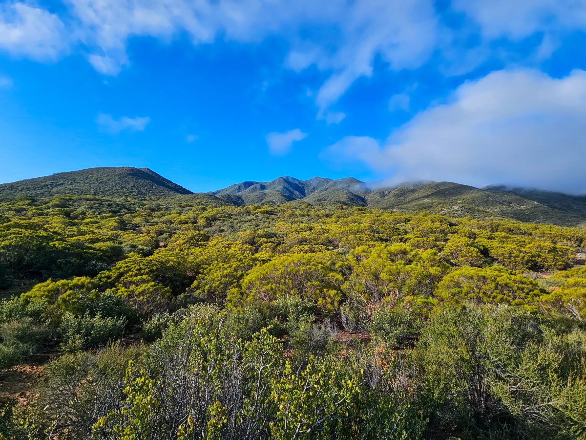
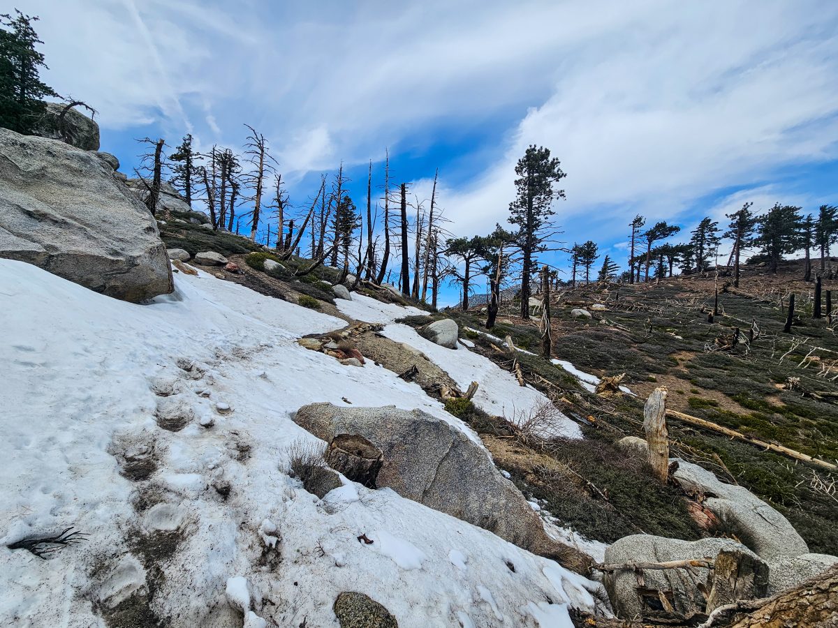
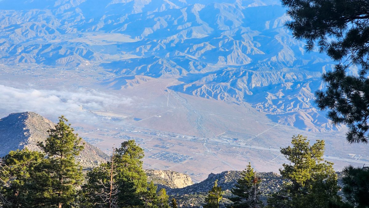
I’m not saying I don’t have these thoughts when I’m solo, but I do find that I am a bit more “in the moment” and present with my surroundings. The sounds of birds chirping and lizards shuffling across the trail remind me that I’m not on a highway to the next gas station, but rather a dirt path that intentionally runs through as many wild and scenic places as possible. The PCT could easily be a straight line from border to border, but it isn’t. It was purposefully designed to follow every mountain contour, to pass by every lake and stream, and to lead hikers through every inch of raw, natural beauty imaginable. Why hike 2,653 miles if you aren’t going to soak in every single view along the way?

On day 22, I saw my first horned toad of the trail. He was quite a big guy and my first instinct was to reach forward and pet him with my index finger. Surprisingly, he allowed it and even seemed to encourage it as he didn’t flinch in the slightest as I rubbed his back for about ten seconds. Growing up, we always considered rubbing a horned toads back to be good luck. Although I only rubbed one toad’s back that day, I counted exactly seven on trail before day’s end. Is that double good luck?

Day 22 was also Mother’s Day. Shortly before starting the PCT, I purchased a small urn with my mother’s face on it, so that I could carry her ashes, and her memory, with me all the way to Canada (and beyond). The warmth of the small pendant against my chest has been very comforting to me and has made me feel a bit less alone on my journey. It’s also helped me to remind myself of one of the other reasons that I’m out here to begin with – to grieve.

That day, I felt my mother’s love in every step I took. Every bird that flew by me and every breeze that swept my face reminded me that I am not alone and that I am truly loved. While my mother would probably not have encouraged me to embark on this particular journey, I know that she still would have been my biggest supporter, regardless of how worried she’d have been. I know that her love, even 9 years after her death, will be exactly what allows me to reach my goals on this trail.

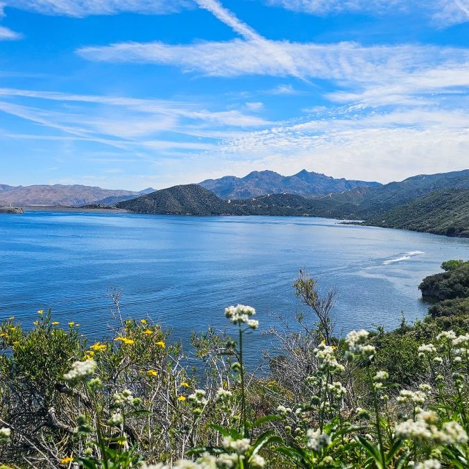
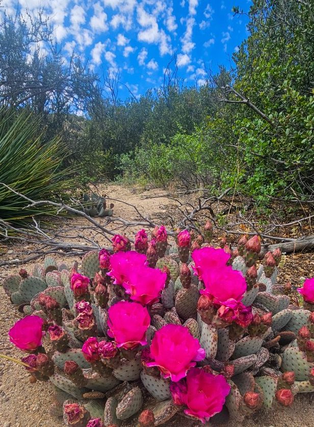
I was shocked at just how much life I saw on trail that day. Maybe it was the warmer weather, or maybe it was just me being more present with the trail and my journey, but I was grateful either way. All the lizards, snakes, birds, and flowers were showing off. This section of desert was teeming with life.

After about 25 miles, I had reached the famous PCT McDonald’s at Cajon Pass. One of those destinations that us hikers never stop talking about. I got there around 6pm, expecting to walk into a dining room stuffed with hikers applauding me like you see in YouTube videos, but instead got there only to discover I was the only one who had made that far that particular evening. That night, I was just another smelly hiker and the McDonald’s turned out to be just another gross pit stop along a freeway – another great reminder for me that it’s really what’s in between these iconic trail destinations that’s really important after all.

The next 2 days on trail were a bit more social that originally planned, but they were also very eye opening and meaningful steps in my journey that week.

The morning after leaving Cajon Pass, I came across a baby deer mouse (or maybe a kangaroo mouse) struggling on the side of the trail. Red ants were all over his tail and back, and one was even in his mouth seemingly stinging or gnawing on his tiny pink tongue. The little mouse was squeaking in pain. He was on a bit on an incline and kept rolling onto his back, struggling to keep upright. I felt sick to my stomach. Should I intervene? What do I even do?

I paced around looking for signs of other mice or a den where his mother and family might be waiting for him. I found nothing. After a few minutes, I decided I had to do something. Animals suffer all the time, and although what was happening was completely natural, it just felt wrong. Nobody deserves to die that way.

I moved him down the trail, away from the ant attackers, using two sticks like chopsticks to lift his little body up. I managed to get all of the ants off of his body using my sticks, struggling to pry the angriest ant out from his mouth. He was still squeaking in pain. I realized his eyes weren’t even open. He was too young to be on his own outside of the nest. He’d never make it. I got the ant out eventually and the squeaking stopped. After looking around again for signs of a nest, I resolved to just let the little guy be. I moved him off the trail so he wouldn’t be trampled and into a little rock nook where he’d hopefully be safe from the ants. Maybe his mother will find him or maybe a large bird will take him away as dinner for its family. Either way, he’d suffer a bit less now. I can’t imagine what else I could do for him, so I moved on.

Later that morning, while filling up at a water cache (thank you trail angels!), I met a hiker named Chezwick. Chezwick, as it turns out is a professional thru hiker, an FKT (fastest known time) record holder for several long trails. After chatting for a while, Chezwick revealed his goal of finishing the famed Calendar Year Triple Crown (PCT/AT/CDT) in under 220 days, a mind-blowing feat. For most, the PCT alone can take 5-6 months. Chezwick planned to finish the PCT in around 70 days, leaving another 150 days to finish the other two long trails, back to back.

Somehow, I managed to keep pace with Chezwick the rest of the day. We hiked 23 miles with 5700ft of elevation gain together that day. I was fascinated by his stories of past achievements and failures. Chezwick had really seen and done it all. With eleven years of thru hiking experience, numerous FKT records, and advice and suggestions for every inch of long trail in the US, his dedication to the sport was beyond impressive – but it also reminded me of my own goals.

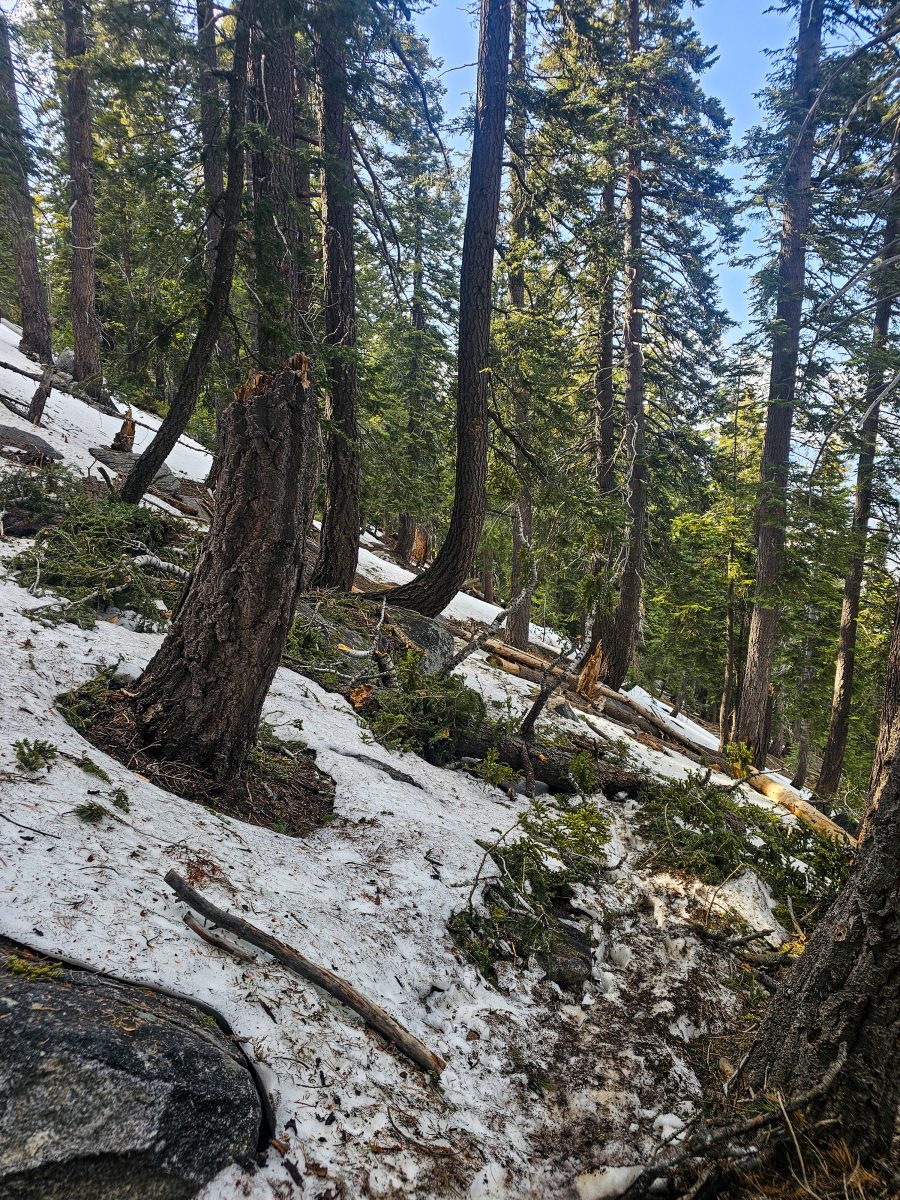
The whole day I hiked with Chezwick, I saw very little of what was in front of me. Although the day was filled with tiring roadwalks and miles of burn scar from 2024’s Line Fire near Wrightwood, I realized that while hiking with Chezwick I was very distracted. His stories of fame, glory, and loneliness (go figure – hiking 40 miles a day can be a very lonely life!) had me hooked, but also pulled me away from the present. As much as I enjoyed getting to know how someone like Chezwick operates and hearing the inside scoop on the sport side of thru hiking, I think my most important lesson that day was to not let my hike become just that – a race to the finish line. I’m out here to enjoy the wild spaces between borders, not to set records or impress other hikers.

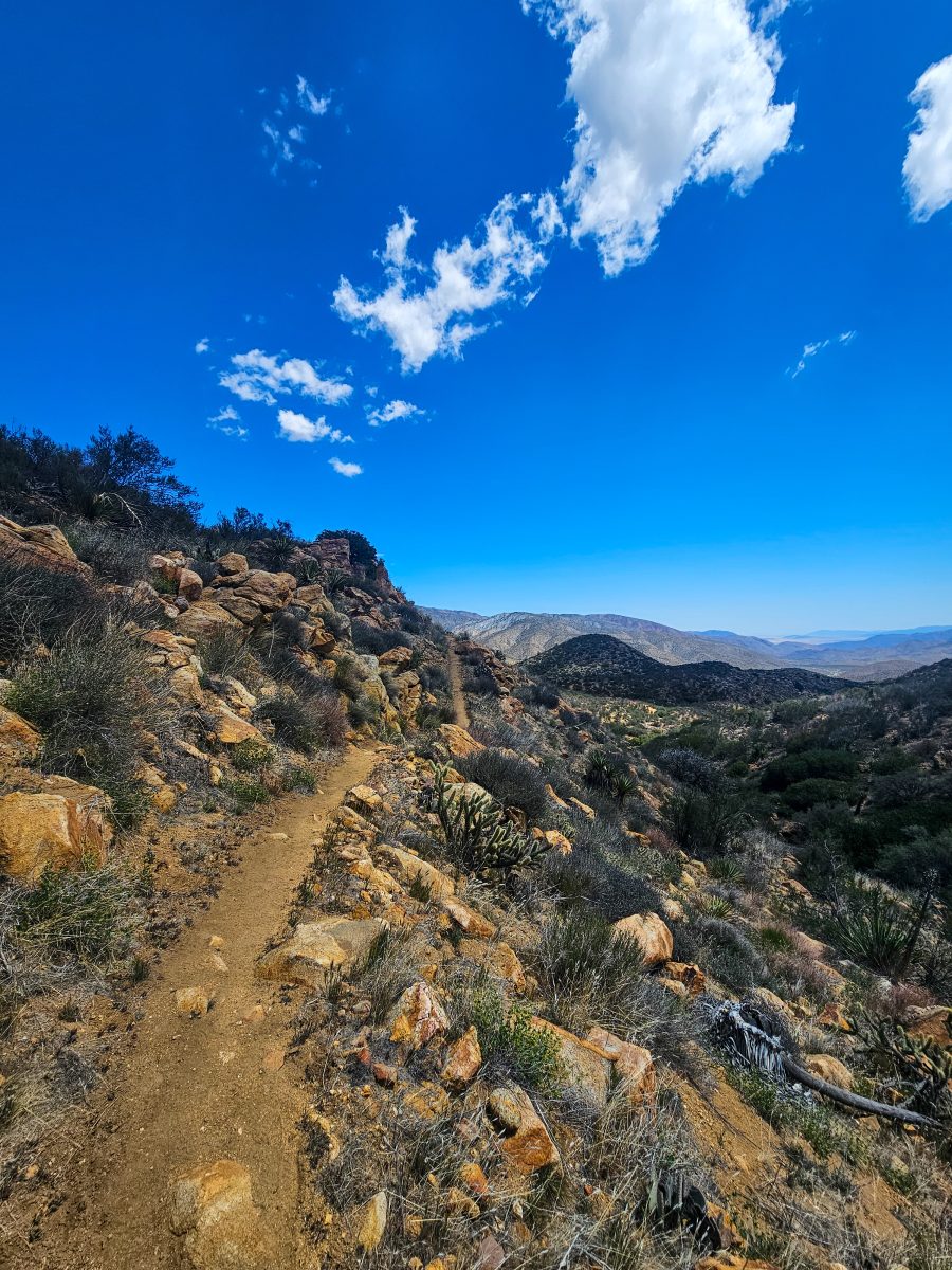
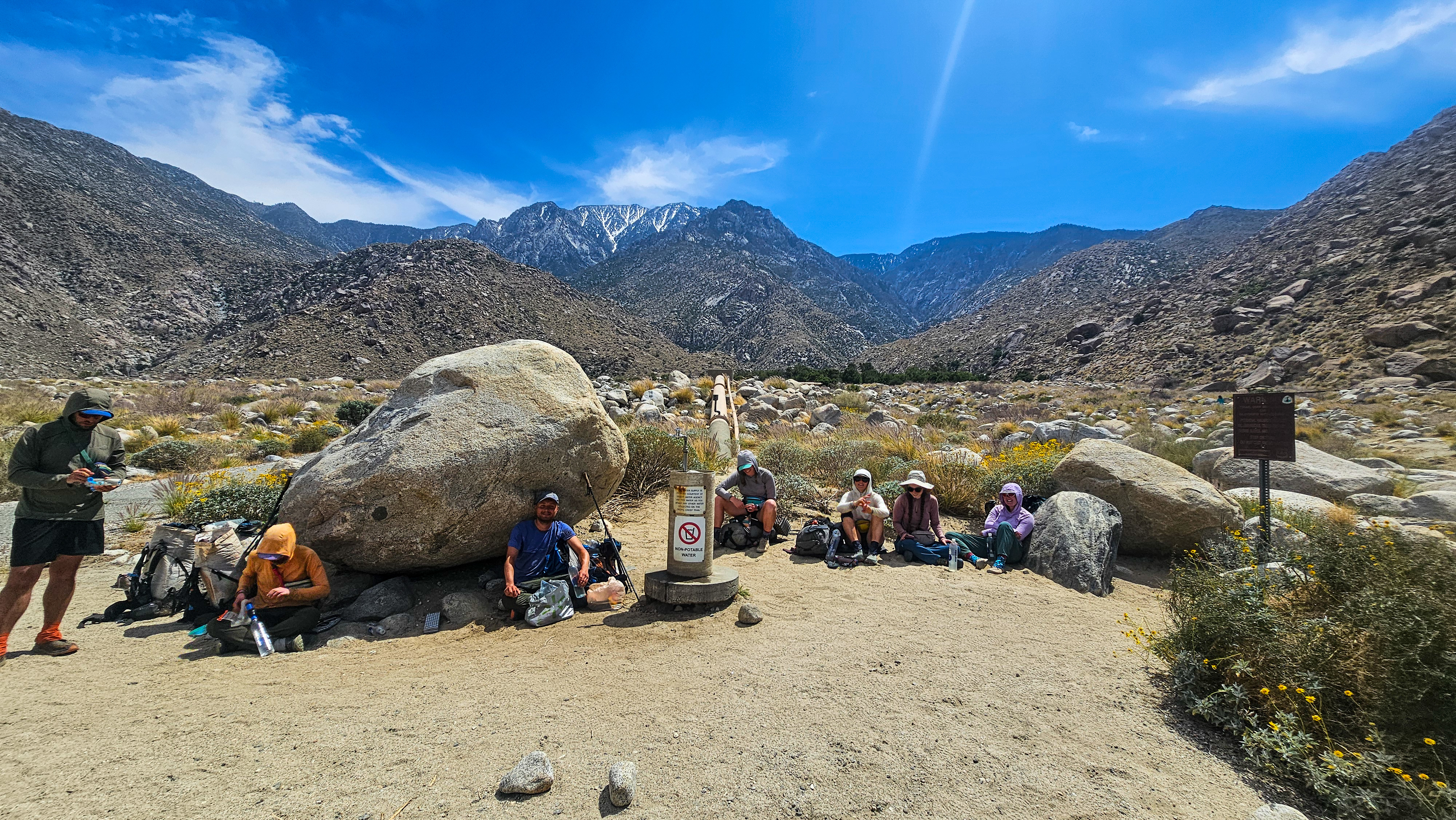
Unfortunately, the roadwalking was not over after my day with Chezwick. The following day, I joined two hikers, Justin and Jamie for an 8mile road walk out of Wrightwood towards Baden Powell. The previous year’s fires had shut down about 20 miles of trail, and our only options were to either hike the roads to and from Wrightwood to get back on trail at mi 374, or get a ride from a local – something I was trying to avoid in order to maintain my “continuous footpath” – more on that later, perhaps.

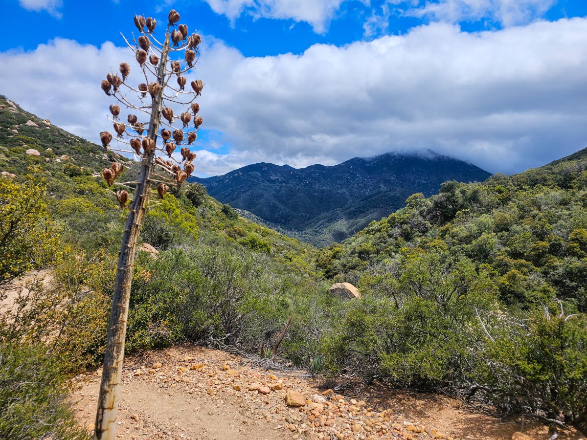
Fortunately, after that morning’s long walk up a closed highway, we were met with breathtaking views of Baden Powell covered in clouds. The hike up to the summit was steep and tiring, and we saw very little from up top due to aforementioned clouds, but it was an amazing experience.

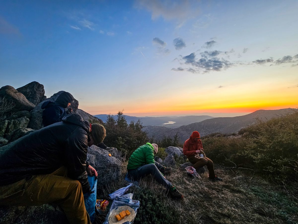
I enjoyed hiking with a little group again, but I knew it wasn’t meant to be forever and that it wasn’t what I wanted in the long run anyway. The next morning, after a freezing cold night and a fairly late start, I told the boys I’d hike solo that day, but would probably meet them to camp later on.

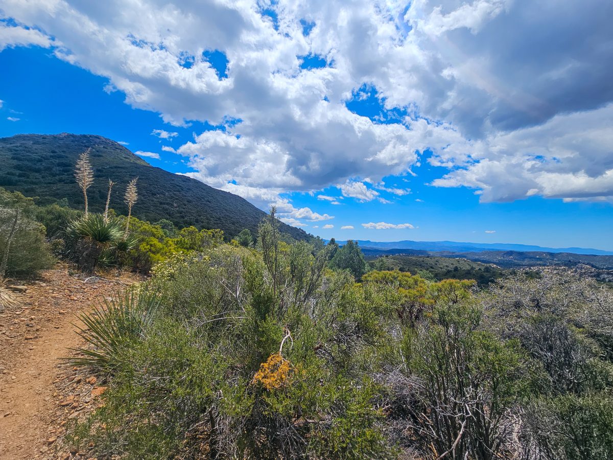
For the next few days, we did just that. We’d camp and eat together in the evenings, maybe meeting midday at water sources, but not really planning anything in particular. During the day, I hiked alone and did what I wanted. I took my time and soaked in my surroundings.

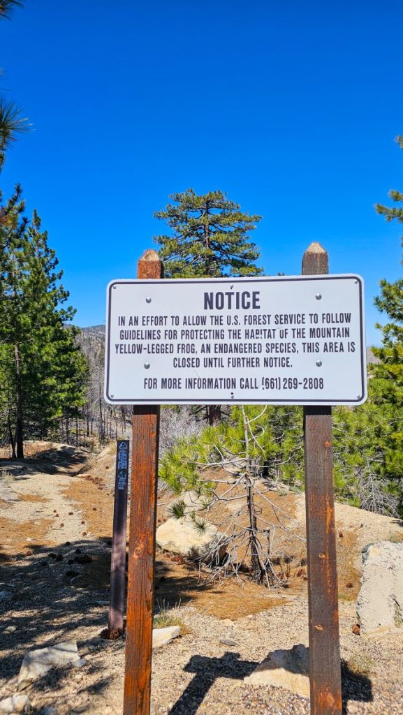
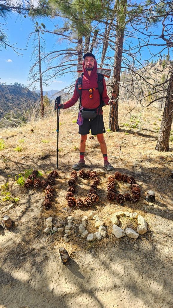
On day 25, I walked what I call the “Toad Road” – another road walk, but this time to help protect an endangered frog species in the Angeles National Forest. This section of trail may be closed indefinitely at this point, but I’m all for doing my part to aid in conservation efforts. The roadwalk was only about 4 miles this time, so I spent the rest of the day enjoying real trail and some fun forest scenery. I also reached the 400 mile marker!

On day 26, I was stung by a bee while kneeling down at a water source. As I moved further west on trail that week, I was making my way out of the San Gabriel Mountains and back into the desert, so water started getting more and more scarce again. Less water typically means more wildlife at the few and far between sources, and in this case that meant a lot of bees! This was my first time I’ve being stung, and I think it may have been less of a sting and more of an “ouch, I just crushed a bee with my knee and it’s stinger happened to jab me!”

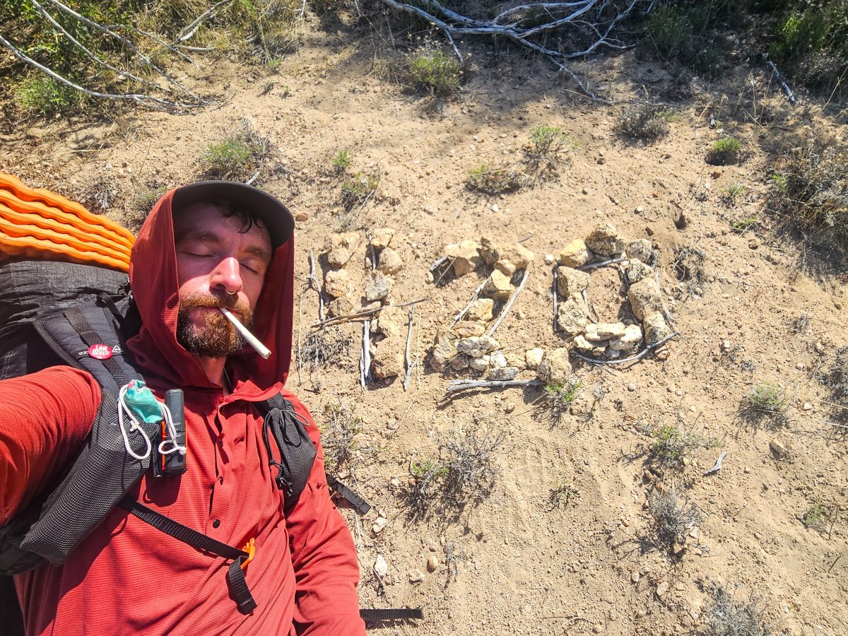
Later on that day, shortly before mile marker 420 (hehe), I stumbled upon some amazing trail magic. Marco, a local angel had set up at a fire station just off the trail and had pizza, snacks, fruit, beer, and weed for PCT hikers. I hung out for an hour or so and got my fill on pizza and fruit while catching up with some hikers I’d been seeing on and off the last few days. Nothing hits the spot like pizza, thanks Marco!

On Day 27, I made my descent down from the mountains toward the small town of Acton, where I had sent a resupply box. After getting water from another spring absolutely swarming with bees, I ran into an absolutely enormous rattlesnake. At this point I had already seen a rattlesnake on trail once before, and had heard tale of dozens from other hikers who I’d been minutes apart from, but this was my closest encounter. Surprisingly, I walked clear past the snake, maybe 6 inches away from its body without even noticing it and it didn’t make a single sound! Maybe I had unknowingly traded in my horned toad good luck at that moment?

After getting down to the highway, I grabbed my package from the nearby KOA and got a quick ride into town, where I stayed the night behind a western-themed restaurant that hosts hikers. (I also got a free meal from a local!)

The next day I took a “nearo” and used the morning to catch up on my last blog post. I eventually hit the trail around 3pm, just as the rain started – yay! The plan was to hike 8 miles or so to Vasquez Rocks, a nearby county park famous for its iconic rocks featured in some old Star Trek movie. Unfortunately, I had been misled into believing I could camp there, so I had to push another 4 miles into the town of Agua Dulce, where my only camping option for the night was at a so called “hikers oasis” aka some Farmer’s backyard where you have to pay $30 to camp next to 50 other noisy hikers!

Overall, week 4 was a very eye opening and insightful week for me on trail. Although I was technically alone again in the sense that I wasn’t part of an established group anymore, I quickly learned that I was never truly alone, what with all of my new animal friends and the love and courage gifted to me from my mother and my sweet Cappy. I was also reminded to focus on my real goals. I’m not out here to walk to every gas station or to get to Canada as fast as possible, I’m here to enjoy every inch of trail along those 2,653 miles.

WEEK 4 TOTALS

Miles Hiked this Week: 141.6 miles

Elevation Gain this Week: 25,643 ft

Total Miles to Date: 455 miles


PCT WEEK 3 – Wear and Tear

I’m writing this blog a good bit behind schedule. It’s been getting harder and harder to find the time to write and to edit pictures. Typically, by the time I get to camp I’m pretty focused on eating and getting to bed. This may end up being the last long format style blog I write, at least for now. I may consider doing weekly recaps instead of day by day breakdowns for future posts. I’m starting to see the quality of my writing and story telling deteriorate, so I think my best move may be to try to keep things brief. More on that later.

Week 3 tested me. It was painful in many different ways and left me feeling absolutely defeated. From a tough, mentally draining and physically straining climb up a washed out creekbed to days on end fighting the relentless sun, I was starting to feel like I was fighting a losing battle. With nearly constant pain on my blistered toes and a food bag that never seemed to get lighter, I also started to question my planning and preparation.

However, by week’s end, I faced an even more difficult challenge – the decision to say goodbye to my newly formed trail family and to head out solo again, a decision fueled by a moment of frustration and a choice nurtured by a lifetime of isolation.

DAY 15

I spent last night at an old friend’s mom’s house. He lives in LA but his mom lives fairly close to the trail, so it worked out nicely for both of us. He got to visit his mom and I got a chance to get off trail during some particularly nasty weather.

After a lazy morning sleeping in, working on last week’s blog, and answering every possible hiking-related question imaginable, I eventually got back on trail around 1pm. The weather was not looking too great, and unfortunately, the forecast hadn’t changed much since last night. It looked to be snowing to the south on San Jacinto, as well as to the northwest on San Gorgonio. Thick rain clouds painted the sky in pretty much every direction.

I got on trail and passed through the small community of Whitewater. The plan was to hike about 16 miles and meet Biped and History for camp – both of whom had already started hiking much, much earlier. The rain spared me for a few hours, but I had to deal with some pretty heavy winds as I made my way through the Mesa Wind Farm.

Once I passed the office for the wind farm, the skies seemed to clear. I unzipped my rain jacket for some ventilation, but was weary of removing it just yet. I made the right choice, as it started raining just a mile or two past the wind farm. I trudged through rain and heavy winds for another few miles, as I made my way up a ridge, and then down to Whitewater River, the largest water crossing in the Desert Section of the PCT. The trail was a bit washed out at this point and it took a few minutes to find a decent place to cross the river. It was nothing compared to river crossings I’ve done on past hikes in the Sierra, but the water was swifter and deeper than anything I’d seen so far on this hike.

After crossing the river and somehow managing to keep my feet dry, I pushed onward up into the hills to the east of Whitewater. The trail climbed up yet another ridge, before flattening out for a couple of miles. I could now see the cloud-engulfed, snow capped San Jacinto in the far distance behind me. I couldn’t have been more grateful to be off that mountain today.

Unfortunately, even as far away as I was, it was raining a lot harder at this point and I was starting to get a bit uncomfortable. I was committed to meeting Biped and History tonight, as I didn’t fancy the idea of tackling the dangerous washed out portions of trail alone tomorrow.

The trail eventually dropped down into another canyon and began following the famed Mission Creek upstream. After crossing the creek, I spotted my friends’ tents. I somehow managed to get to the same tentsite, although i had started at least 4 hours after both of them. It was 7:30 by the time I got inside my tent, and I was absolutely elated to be out of the cold rain. I hung my jackets to dry on my pole in the vestibule and began preparing dinner.

I was just started to unwind when I realized the unimaginable had happened. My spoon was missing. It must have fallen out in the car. What a sad way to end an already miserable day. I guess I’ll be making all my meals into soups the next few days..

DAY 16

It rained pretty much the entire night. My rain jacket and pants never really had a chance to dry from yesterday’s hike. I packed up my gear and chatted with History, Biped, and their buddy Ed, who was also camped nearby. Everyone was a little shocked that I didn’t start my hike in until 1pm yesterday, considering the distance and the weather.

We all set out around 7:30 am, but after crossing into the notorious Mission Creek wash-out section, the group quickly fell apart. Biped and I stuck together for the rest of the day though.

We hiked through at least ten miles of washed out riverbed where the PCT and everything surrounding it had been completely obliterated by 2023’s Hurricane Hilary. The trail now only existed in small segments, 10 plus feet above the riverbed. I’ve never seen such intense erosion. I really struggle to imagine what the trail even looked like before the hurricane.

The hiking was rough, to say the least. Every step required careful planning, so as to avoid rolling ankles or slipping into the creek. We must have crossed Mission Creek 50 times today. Previous hikers had laid cairns along the riverbed, but they weren’t always useful and often contradicted one another. It was easier to just follow the creek upstream and look for the path of least resistance – ie less boulder hopping, less creek crossing, and more flat ground.

To make things worse, the sun was only out for maybe the first hour or so. The rest of the day was on and off sprinkling and ominous storm clouds gathered up creek from us. We eventually got to point where we saw fresh snow from the night prior on the hills above us. This was certainly disconcerting, as we knew we’d plan to camp at something like 8k ft tonight.

We pushed on. Eventually, we were back on trail (mostly) and started a rapid ascent up switchbacks above the creek. We were exhausted. Boulder hopping, mud sliding, tree hurdling, and creek crossing for 5 hours had broken us. We were desperate to get to camp.

At around 3pm, we’d finally made it. 14 miles and 5200 ft of vert later, we were at Mission Creek camp. This would have been light work three years ago before the hurricane, but now it’s arguably the most difficult section of the PCT in SoCal. No wonder so many people talk about skipping it.

After talking about food all day, we were ready to feast. Both of us had overpacked food, not knowing how long it would take us to get to the next town and both of us were obviously not eating enough anyway. I have a bad habit of just pushing through a day’s hiking without stopping to eat, and I worry it’s rubbing off on Biped. I crammed as many calories in as I could at camp, but it was almost too cold to even stand or sit still.

Snow clouds continued to gather in the hills behind our camp and a nasty wind kept ripping through as soon as things started feeling comfortable. Within another hour and a half, the rest of the group showed up and we paced around discussing our approaches to the day’s challenge. I also got caught with my pants down, mid cat-hole for the first time so far on this hike – hopefully this isn’t leading to any unfortunate trail names..

I can only hope the rest of the desert section is only half as demanding as the last few days have been!

Day 17

It was absolutely freezing last night. I could hardly sleep. It didn’t help that another hiker, an older gentleman who had never backpacked prior to hopping on the PCT, set up camp directly next to my tent just as I was getting ready for bed. He was in his tent rummaging around for hours on end before finally laying down and grunting the rest of the night.

Temps got down to the mid 30s, and lingering snow in the vicinity led to more moisture buildup in the tent and on my quilt, so long story short – it was a rough night. Fortunately, the sun made a delightful return this morning. Biped and I dried some of our gear out while moseying around camp. It’s remarkable what 30 minutes of sun exposure can do to remedy wet gear.

We weren’t in any rush to hit the trail, as the upcoming miles were anticipated to be a lot milder than those hiked the past few days, at least as far as terrain and elevation gain.

The rest of the day on trail turned out to be just as expected. We passed through some patches of fresh snow here and there, and climbed a few ridges engulfed in some sort of cold, foggy mist (I’m from the desert – I don’t understand these things..), but it was overall a really enjoyable, mellow day. We didn’t have many captivating vistas or remarkable landmarks, apart from the snow-capped summit of San Gorgonio behind us, but it was an easy, relaxing day that felt very well-earned after the mission creek nightmare from yesterday.

The only listed natural water source on trail today had apparently been contaminated by a dead raven about 2 weeks prior, but we lucked out finding an unlisted water source directly on trail, most likely resulting from the rapid snow melt in the area. Dead raven jokes continued for the rest of the day, regardless.

Biped and I hiked just shy of 20 miles, my longest day in over a week at this point. It felt good to put in some low effort, longer miles again.

After we got settled at camp, we were joined by an older German lady who we met the night prior as well as History and our new friends Rookie and Ed who we met at Mission Creek. We all enjoyed a beautiful sunset over Bug Bear Valley. I used a rock to eat my dinner, hopefully for the last time, as we’d be having a much needed resupply day in Bug Bear Lake tomorrow!

Day 18

We got up early and had a pretty uneventful 7 mile hike to the highway today. We couldn’t wait to get into town. The town food cravings were starting to get painful. I was also excited for a hot shower and laundry.

After getting to the highway, we got a ride from an angel waiting for hikers at the hitch spot. He gave us a very detailed grand tour of the town we’d never have the time or energy to see anyway.

Our first stop was at a breakfast diner. The food was okay, but the cook was amazing. I’d never seen someone single-handedly prepare so much food so quickly and efficiently. Working in tourists towns must require a lot of patience and drive.

Biped and I were absolutely exhausted after eating. Outside the diner, I talked with another hiker about the a much dreaded detour around a fire closure in the Wrightwood area. We exchanged info and plans for walking around the closure. Most hikers seem to be planning to hitch or get angels to drive them around the fire. Personally, I’d like to maintain a continuous footpath for as long as possible – in other words, I’m not willing to skip any miles at this point.

Afterwards, I went to the post office to pick up a package that Tiphane had shipped me. Biped and I grabbed some empty boxes to prep food for the next couple towns as well. We got some ice cream at Ben & Jerry’s (hiker discounts rock!) and I stopped by a gear store to get a new spoon – yay!

Everyone in town was very hiker friendly. We were approached by a number of people on the street and asked about our hike. Locals and tourists alike seemed genuinely interested and invested in our adventure. We were offered ride by a stranger while walking to our hotel and all the local shopkeepers were very generous with discounts and suggestions as well.

Once we got to the hotel, I did sink laundry and listened to some music on the TV. This felt so good and really lifted my spirits, as I haven’t been listening to any music on the trail. So refreshing.

Biped and I spent the entire afternoon grocery shopping. We got an insane amount of food, both to to pack out for the next leg and to mail forward first the next three trail stops. We walked around so much, it didn’t feel like a nearo. Our town miles combined with this morning’s trail miles basically made fir a full day.

After our shopping spree, we had dinner with the whole crew – History, Ed, and Rookie. I’m happy to say that I’m feeling very at home hiking and camping with a group now. I feel like we have a nice little community forming, even if we split here and there.

Looking at the full spread, I have no idea how I’m going to handle this food in the morning. It’s honestly overwhelming to imagine packing this all up, mailing it out, and then hitting the trail. I’m going to have a nice little epsom salt soak and unwind before bed. Town days arr the best!

Day 19

I scrambled to pack up my resupply boxes all morning. I was seriously going crazy. There was just too much extra food. The boxes ended up being a lot bigger than originally planned and my food bag for the week was mighty heavy as well. I knew I’d regret this later, but I didn’t know what else to do that didn’t involve spending more on postage. Biped and I both set aside some surplus for the rest of the crew after packing our boxes to max capacity.

Before leaving, I took one last shower. We then found out about a hot tub and sauna on site AFTER checkout. (And free laundry too, what the hell!)

After checking out, we finished taping and labeling our boxes in the hotel lodge. I was so tired from staying up late that messed up address on the first box three times. We got a ride from the hotel owner to the post office in his giant lifted El Camino – compensating much? Regardless, we felt like VIPs for the whole 1.5 mile drive to the PO. I mailed my boxes out, then grabbed some post cards to send to family.

Biped and I got a Lyft back to trail around 3pm and decided to hike in about 9 miles. Our bags were so heavy. The extra weight is so not fun with a frameless pack. I felt stupid for overbuying. It was the longest 9 miles uphill with, disappointingly, no good views of lake. At camp, we ran into some other hikers Biped knew and we all had dinner together. I did not eat as much as I wanted. The plan was to knock some weight off my food bag, but my appetite was low and I was a bit tired of my food already. We are planning to push 20 miles tomorrow and start finally catching some longer days moving forward.

Day 20

It was freezing cold all night, that was so not expected after our two warm days in/near town. I had a pretty tough time sleeping and woke up soaked from condensation in my tent. It was apparently only 31 degrees at 7am, so I’m assuming it was much colder overnight.

We stayed at camp till 8ish to get all of our stuff dried off. I had a big breakfast- something I’m going to make an effort of doing everyday now, moving forward. I’m adding protein powder to my oatmeal now and making PBJ with tortillas.

Today was a tough day, although we had some arguably very easy trail. My toes were just really hurting. It looks like my blisters were probably coming back and my pack was just too heavy with food still. Additionally, we are hiking west towards the sun now. (For the next couple hundred miles) Oof.

To switch things up, Biped lead the way today. It was the first time I had hiked behind a partner on the PCT. He raced ahead of me, not really trying to match my pace. Regardless it was nice to take my time a bit and to not feel the pressure to lead.

We finally caught some lake views for a bit, but spent most of our time hiking through burn zones and scattered bits of forest. There were no more Joshua Trees, unfortunately. At our midday break, we saw Ed and Rookie. They had spent an extra night in town, but took a side trail out of town to catch up with us. I soaked my feet in a cool creek and took a much longer break than usual. This felt amazing. I have to do more of this.

The last 10 miles of the day were absolutely painful. The sun was just too much and my toes were really hurting at this point. Near the end of the day, the trail crossed the creek a few times. We crossed on logs and rocks, and I ended up falling in during last crossing.

I got to camp exhausted and soaking wet. For once, I actually ate a bunch of food. Unfortunately, my toe blisters had returned after all. They were pretty bad. I’ll need to keep my toes wrapped better and use start using cream to reduce friction. I popped the blisters and covered them for the night.

Afterwards, I had a second dinner and lay down in the sun. Biped and I didn’t talk as much today. I guess we were just kind of in our own heads all day.

I was delighted to see several bats flying around our tents after sunset. This was definitely one of my favorite camps so far. I’m a big fan of the more isolated, lonely sites like this one. The less hikers, the better.

Day 21

I woke up feeling amazing. I had such a great sleep last night. It was the perfect temperature all night and, for once, there was no wind and no condensation.

Good sleep helped me to get moving a little faster this morning as well. Also, doing big breakfasts now is definitely making a difference as far as motivation to hit the trail.

It got hot pretty quickly into our hike. Throughout the day, we pushed on through the desert along Holcolm Creek towards Deep creek. Around mile marker 300 (yay), we caught up with Rookie and Ed again and enjoyed some time dipping our feet in the creek. Some guys on dirtbikes showed up and sort of ruined the vibe of the spot, so we got moving again.

We pushed on northward along Deep Creek. The trail was great until it wasn’t. The views of the creek were fun at first, but started to get really repetitive after 5 miles or so and the hiking started to wear on my toes. I was also beyond tired of walking in the sun already. I didn’t miss the rain, but I certainly wasn’t feeling too hot about walking directly towards the ball of fire in the sky.

We pushed the last couple miles to hot spring with the group and made it around 2pm. Unsurprisingly, it was super crowded. The pools were full of naked old men and local partiers. I got in the closest hot spring pool and instantly regretted it. My poolmates were loud, obnoxious Trump supporters blowing cigarette smoke all over. I waited till they left and got back in. It was very refreshing to soak in the hot water, even on such a hot day. My muscles really needed it, I guess.

After 40 minutes or so, I felt a bit of pressure from the group to start packing up. Nobody else got in the hot springs (favoring the cool creek instead) and they were waiting by our bags. I made my way back up and packed my stuff up and we hit the trail again.

I decided to walk behind the rest of the group because my toes were still bothering me a good bit and I didn’t want to rush the last 6.5 miles. We had already hiked 13 miles to get to the hot springs. Pretty quickly after leaving the whole group blasted ahead of me. Biped was easily a mile or more ahead at one point. I get that everyone wanted to make camp and get out of the sun, but I was also disappointed that nobody waited for me.

Our plan was to stay at the Joshua Inn and get a $5 campsite tonight. As the group got further ahead, I wondered if they would just get a ride without me. The sun was driving me nuts. I was beat and over it and was starting to lose my head around bit. As I thought more about the group not waiting for me or checking on me, knowing I was struggling, I started to get a little bitter. I started to wonder if I should leave the group tonight.

I eventually found them sitting by the creek 6 miles and two and a half hours later. In the heat of the moment, I walked passed them and informed them I was splitting from the group and hiking ahead to camp a few miles further up the trail. I’m not sure they understood, but I just wanted to be alone.another fifteen minutes later, we got to the road leading towards the Joshua Inn and they asked if I was joining – I said no and that I felt offended by the whole not sticking together style of hiking.

I painfully pushed on another 4 miles to find camp near a water source. I hiked just over 23 miles today. Ouch. By around 7:30, I set up camp near some people I’d never seen before. I felt bad about making camp so close by and so late, so I tried my best to move quietly while I made dinner.

It was pleasantly warm tonight. I’m hoping to catch up some rest after an exhausting day. I guess I now have a lot to process and think about after leaving the group behind. It’s going to be a little tough moving on on my own again, although that’s always been my style in the past.

WEEK 3 TOTALS

Miles Hiked this Week: 109.6 miles

Elevation Gain this Week: 18,707ft


PCT WEEK 2 – Highs and Lows

My second week on trail surprised me. For once, I found myself enjoying the company of other hikers. I was making genuine connections and enjoying time spent chatting and sharing meals with people on the same (yet still very different) adventure as me. I found myself longing to know everyone’s stories. I wanted to share the sights and sounds with friends, instead of resenting not having every vista to myself. Something was starting to change and I found myself embracing it. I knew nobody would be around forever, so I might as well enjoy the good company while it lasted. I’d undoubtedly have many, many more days alone ahead.

DAY 8

After a bit of a rough night’s sleep by the creek, I got up early for a free pancake breakfast at the Warner Springs community center. It was still freezing cold and raining and I had trouble sleeping because the Japanese hikers camped next to me talked until 10pm and then proceeded to snore all night. The pancakes were great though. Giant, 1inch thick, plate sized pancakes – with endless syrup and peanut butter. Legend, the angel/hiker who prepared the food and hosted the prior day’s lecture gave some questionable advice about thru hiking and made some fairly insensitive comments about “real” vs “fake” thru hikers, but I think it was taken with a grain of salt by most of the group.

After getting my fill, I was ready to brave the rain and hit the trail. I was starting to feel like I’d overstayed my welcome at the community center. The accommodations had been lovely and it was nice to finally unwind a bit from hiking, but I knew getting too comfortable would only make it harder to get back out there.

I hit the trail around 7:30am. It was still rainy for the first hour or so, but the first few miles of trail passed through a lovely meadow. As the rain came to a gentle stop, cows started to wander into view and a rainbow shimmered in the distance. It was a bit of a magical moment, standing all alone in a seemingly endless meadow with a rainbow touching the trail in the distant horizon – a good reminder for me to practice gratitude and to focus on the present vs the “5 miles to this point, then 5 miles to that thing” mentality that often dominates my headspace.

The trail then meandered uphill along the scenic Agua Caliente Creek for another hour or so. It was still very cloudy and a bit windy, but this section was so beautiful. It felt a bit like I was in Hawaii again, given how humid and lush it was.

I played leapfrog (when a hiker passes and then is passed by another hiker repeatedly throughout the day) with Asa and Traffic Cone, two hikers I’d met the night before at the community center, all the way up the creek. Traffic Cone, an older hiker from Florida, got his name from his younger hiking companion, Asa, because of the bright orange shirt and hat he adorned. The duo had previosuly hiked the Appalachian Trail together and were pushing consistent 20-25 mile days on the PCT. At this point, both of them insisted that my trail name was Kilometer. I’m still not super into that, as it doesn’t seem that creative or relevant to my hike, but oh well – maybe something better will present itself later on.

As I made my way up the mountain, I eventually got a mile or so ahead of the duo and ran into a few other hikers that I recognized from the community center. Around 5000ft, the clouds eventually cleared for a bit, but then suddenly got bigger and even darker. I pushed onward in hopes of getting water and setting up camp before it started raining again.

On the other side of the mountain, the trail was a lot less lush and a lot more reminiscent of hiking in the NM high desert. After about 18 miles, I got to the famed “Mikes Place” – the first water source since the creek and a historic hangout for PCT hikers. After hearing tales of the place, there was no way I wasn’t going to check it out now.

Mike’s Place was quite strange, to say the least. The walls of the garage and house were graffitied with PCT hikers’ signatures and drawings, and there was classic rock playing from a scratched CD (skipping every 10 seconds or so) and a trash fire burning in a fireplace standing in the middle of the yard, but seemingly no one was home. It turns out, Mike’s Place was just a dirty, dingy place with meth lab vibes. Maybe its hiker haven days were over? (Later in the week, I heard stories of Mike or a friend of his hosting hikers at the property and serving them questionable meals and making awkward advances at women)

After making my way back up to the water tank up the hill, a few more hikers showed up and declared they were staying at Mike’s for the night, but a young guy from Asheville and I decided to push on another 5 miles north. By this point, the weather started looking really bad, so we just wanted to get off the mountain and camp low. I ended up with almost 23 miles by the time I made camp. This was probably one of my strongest days on trail since day 1! The climbs were aplenty and the miles long, but my body felt great. Spending that half day at Warner Springs really did pay off. I also switched to wearing only liner toe socks (vs wearing liners AND wool socks) and had less issues with foot pain. Before bed, I tried to do some maintenance on some blisters I had gotten days before and they were not looking great. I’d need more bandages soon.

DAY 9

The sun finally came back out before breaking camp this morning- what a relief, at least until it got uncomfortably hot and exposed. As I was still climbing down from the previous day’s mountain, there was a good bit of downhill for pretty much the entire day. The desert views were great though – some of the best since the section before Scissors. Cacti and agave lined the trail, and lizards were once again seen basking in the sun around every corner.

I got off trail twice today for water and snack detours. As there were no natural water sources for the entire day’s hike, I had to rely on local trail angels for water. I played leapfrog again with Asa and Traffic Cone for pretty much the whole day. We hung out a while with a bigger group at one of the trail angel’s houses and got some fresh fruit and soda. It felt great to sit in the shade with my shoes off for a while, catching up with other hikers. Even a desert boy like myself needs to cool off and escape the sun for a bit.

I eventually lost the pack when I got off trail again to check out Little Bear Hostel, the second trail angel’s house. It was a fairly big detour off trail, but it was soo worth it for water, veggie dogs, shade and a surprise chance to hang out with a tiny kitten! He was all over me the second I sat down. I’ve never known a cat to voluntarily sit on my head. It was just way too cute and felt like my baby Cappy was ending me an angel – a very special moment I won’t soon forget.

I eventually got back on trail and tagged the hiker I met at Mike’s Place the day prior. We hiked 5 miles together to the famous Paradise Valley Cafe – a restaurant right off the trail that’s famous for feeding hungry hikers before they begin the climb up the San Jacinto Mountains. It turns out Ben and I have a bit of a connection in that we both lost a parent at a young age and we’re both hiking the trail in hopes of finding some closure and peace. We also realized that both of us carry the ashes of our deceased parent in small urn necklaces. Ben is very religious and plans to propose to his girlfriend after carrying an engagement ring all the way to Canada! He is a very sweet and very romantic young man.

By the time we got to the restaurant, I ended up logging 24.5 miles. Both of us were absolutely exhausted. Asa and Traffic Cone were already at PVC with two other hikers who’d gotten off trail due to a storm on San Jacinto that weekend. We all cowboy camped right on the porch of the restaurant – something I obviously never would have even considered doing if I were alone that evening. It was fairly warm under the awning, considering it was close to 30 degrees that night, but I got some pretty miserable sleep. Sleeping 100ft away from a highway next to a bunch of stinky hikers just wasn’t doing it for me. I prefer being in my tent up in the mountains.

Day 10

I woke up feeling extra homeless this morning. It must have had something to do with sleeping with a bunch of stinky hikers on the front porch of a diner. Go figure. We were all up at sunrise and gathered our things while we waited for the restaurant to open. Once the kitchen staff showed up and opened the doors for us, we all raced inside like we’d never eat again. Within another 10 minutes, another dozen or so hikers showed up.

Ben (who I started calling Bible Ben in my head, since he carries a bible in his pack) joined me for breakfast and we discussed strategies for the upcoming climb – where to camp, how much water to carry, etc. These kinds of discussion account for at least 90% of what hikers talk about on trail.

After breakfast, I ended up separating from everyone because, before leaving for San Diego, I mailed myself a resupply box to the restaurant that I now needed to unpack, organize, and cram into my food bag. After getting that situated, I hiked solo up into the San Jacintos for about 12 miles. This was a slow slog for me, as I was pretty damn tired from the absolute lack of sleep the night prior. The milkshake I had with breakfast wasn’t exactly helping either. Pushing 24 miles as I had the day prior was absolutely out of the question.

As I made my way up further into the mountains, I had some incredible views of Palm Springs and the whole Coachella Valley. The valley floor looked impossiblely far away already. Around 2pm or so, I caught up with everyone from breakfast at Cedar Spring junction, including Brandon, the hiker who let me borrow his phone the night I found out about Cappy’s passing.

Brandon was hiking with a Swiss guy named Cobbler and an English girl named Woody. Cobbler offered to grab water from the nearby spring for everyone, but he didn’t come back for almost an hour. I was worried he had some sort of accident, but I guess it was just a terrible hike down and back up and his filter was just too slow to keep up with getting water for four people. I ended up hiking with the three of them another 4 miles to camp.

In the distance, clouds gathered around the summit of San Jacinto made it look like an erupting volcano. I got some of the best sunset pictures ever tonight and just had a really fun, genuine time. Maybe hiking with a group isnt so bad after all? Biped, another hiker that I’d been seeing for the past 4 days or so joined us for the final mile to camp and stayed with us that night. The five of us had dinner together and watched the rest of the sunset. With our eyes set on the long ridgeline leading up to the summit, we knew tomorrow’s hike was certainly not going to be an easy one, as the ridge has some pretty striking ups and downs before coming anywhere even close to the summit.

Day 11

Considering Brandon and crew had already been into town for their zero day (a zero-mile day – a day off, essentially), their plan was to push on today for the San Jacinto summit. Biped and I planned to drop into Idyllwild for a zero day, so we split from the rest of the group and left early to tackle the 15 miles to Saddle Junction, where a side trail would lead us into town.

The hike turned out to be a lot more than we bargained for. Biped left a little before me and paced a mile or so ahead of me for most of the day, but we both struggled with foot pain and utter exhaustion. This was my slowest day yet, averaging around 30min/mile. I used my trekking poles for the first time as well. They had mostly just served as ornaments strapped to the back of my pack until now, but my broken body could not have handled today’s climbs without them. There were tons of enormous downed trees, some fairly significant exposure along narrow trail, and snow above 8k feet. It was a real struggle, for sure, but the views were unbelievable. The narrow ridge led the trail up and down, over and over again, with striking views of distant valley floors on both sides.

Biped and I finally reunited about 2 miles from Saddle Junction and hiked down the Devil’s Slide trail into Idyllwild together. This additional 2.7 miles and 2k ft of elevation loss was truly the cherry on top after such a grueling day, but it give us plenty of time to chat and get a little more acquainted. It turns out Biped is a cartographer, having worked both in Oregon and New Mexico, we had quite a bit to talk about! He is also very experienced outdoorsmen in general. The name Biped is both an homage to an old family saying, as well as a reminder for him to express gratitude for having two working legs – something that he won’t have forever, as medical complications may lead to amputation for him within the next decade.

After descending, we were able to grab a pretty quick hitch into town from a local. Our first stop was grabbing ice cream at the grocery store, of course. We booked a room for two nights at the lodge and met Woody and Brandon for dinner at a nearby brewpub. Apparently, they couldn’t resist coming back into town for beer and burgers. I can’t say I’d voluntarily descend and ascend Devil’s slide for such a brief visit, but to each their own. Cobbler, the swiss hiker in their party, was still somewhere up on the mountain pushing through the snow.

Biped and I taking are taking a well deserved zero tomorrow and will head back up the mountain on Friday morning. My plan is simple – rest my feet, epsom soak in the tub, and get some extra medical supplies. It will be nice to just lay low, as im not trying to be super social. I know a lot of hikers use town days to party and socialize, but I’m ready to just chill on a real bed!

Day 12

Today was my first zero day in town. It was so refreshing sleeping in a bed and not rushing to get packed up and moving. I spent the day doing doing “town chores” – laundry, shopping, mailing postcards, cleaning and organzing gear, etc. I walked around town quite a bit, which is kind of funny considering we came into town to get a break from walking.

For lunch, I had a gaint smash burger and milkshake with Biped and his Dutch hiking friends. Afterward, we joined a bunch of other hikers and tourists, to meet the dog mayor. That’s right, Idyllwild has a dog mayor. (Who apparently hates all other dogs and does not hesitate to assert his authority)

Biped joined a group of hikers in the park for a BBQ and hangout, but I decided to stay in and have a bit of a spa night to myself. I enjoyed an epsom salt soak and a lazy evening in bed.

Day 13

We had a big, big climb today, to say the very least. Biped and I got up early and grabbed donuts at the local bakery. We each grabbed one extra donut for summit as well. A trail angel gave us and a few other PCT hikers a ride to the trailhead. By 8:30, we were headed up Devils Slide back towards Saddle Junction. Aftee getting back up to the point on trail we left off two days prior, we started to pushed up further towards the summit. We ascended an additional two thousand feet or so and made it up to the top by noon.

My body was feeling very well rested and mostly recovered. I didn’t pull my hiking poles out today, so I knew had my strength back. The ascent was long and there was a good bit of snow on ways up to summit, but it was nothing I hadn’t seen before.

On the way up, I had a brief reunion with Emma, Fruitloops, and Jess – the girls I split a cabin with on Day 5. I was so happy to see them! They were on their way down the summit to do a double zero in town, so the chances of hiking with them would be even less now.

Biped and I saw Traffic Cone, Asa and their hiking companions at the summit of San Jacinto at 10,787 ft, the highest point on the Desert Section of the PCT. Everyone was hanging out outside of the old summit shelter, which is apparently now a mouse haven, hantavirus and all. Yikes.

We had our summit donuts (oh so good) and hung out for a bit discussing plans about an upcoming storm. The group was pretty spooked about the possibility of snoe and wind along the next 50 mile portion of trail. Some had already decided to retreat tp a nearby town to ride it out.

Biped and I left the summit and started our descent. There was tons of snow under tree cover for the rest of the afternoon. The route finding was starting to get a little tricky, as the trail started to be less and less visible under snow and deadfall. At one point, we pushed through a solid 2 miles of slushy snow at a fairly steep angle. It was unnerving and made for some very slow moving, for sure. My feet were still feeling good, but the constant gains and losses were weighing on me a bit mentally.

We ended up finishing the day with 5k feet of elevation gain and 4k feet of elevation loss. I was ready to hit camp and eat dinner. When we got to Fuller Ridge to camp, another couple of groups were already set up. We had dinner with History, who I hadn’t seen since day 6 or so. It was great to catch up and hear about his experiences. The rest of the group showed up an hour or so later and we chatted and goofed off until sundown.

Day 14

Biped and I left camp by 7am today – my earliest start. We knew we had a big day ahead, so we wanted to get going. Fortunately for us, we didn’t encounter anymore snow, but the descent was intense, regardess. The trail switchbacked over and over again all day long.

As we dropped in elevation, the pine forest faded away and sweeping views of the desert below opened up. It was like looking down from a 14er. For a while, all we could see down there was the giant casino in Cabazon, but eventually we made out details of the highway and could see trucks and trains passing below.

We grabbed water at a small creek about 4 miles down, and packed enough to make it another 12 miles to the bottom of the mountain. The switchbacks continued as we dropped down to the base of the mountain, the trail now lined with beautiful desert flora once again. On the way down, we passed the 200 mile marker – I’d now finished a whopping 7.5% of the Pacific Crest Trail! Only 2,543 miles to go!

16 miles later, we had dropped over 7,000 feet in elevation (the biggest elevation drop on the entire PCT!!) and were now gathered with a large group of hikers at a water faucet at the base of San Jacinto. Biped and I “cameled up” and queried the rest of the group on their plans to weather the upcoming storm. Most planned to hide out in town. Biped and I decided to push to the interstate and then make decisions.

After 4 miles of desert wandering through some absolutely brutal wind, we crossed under the railroad and i8. A friend of mine who was visiting family in nearby Yucca Valley picked us up and took us to In N’ Out in Cabazon. I can’t even keep track of how many cheeseburgers I’ve had on this hike so far. My friend and I dropped Biped off at a hotel, as the wind we had just weathered on the push from the mountain drove us into deciding that camping nearby was not going to be an option afterall.

I spent the rest of the night feasting and monitoring the weather, still unsure of how to proceed with the approaching storm. The 50 miles of trail leading to the town of Big Bear Lake are apparently already pretty demanding without wind and rain, so we’d need a solid plan to make it safely through that section.

WEEK 2 TOTALS

Miles Hiked: 114.3 miles

Elevation Gain: 21,167ft