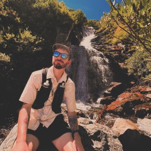
My second week on trail surprised me. For once, I found myself enjoying the company of other hikers. I was making genuine connections and enjoying time spent chatting and sharing meals with people on the same (yet still very different) adventure as me. I found myself longing to know everyone’s stories. I wanted to share the sights and sounds with friends, instead of resenting not having every vista to myself. Something was starting to change and I found myself embracing it. I knew nobody would be around forever, so I might as well enjoy the good company while it lasted. I’d undoubtedly have many, many more days alone ahead.
DAY 8
After a bit of a rough night’s sleep by the creek, I got up early for a free pancake breakfast at the Warner Springs community center. It was still freezing cold and raining and I had trouble sleeping because the Japanese hikers camped next to me talked until 10pm and then proceeded to snore all night. The pancakes were great though. Giant, 1inch thick, plate sized pancakes – with endless syrup and peanut butter. Legend, the angel/hiker who prepared the food and hosted the prior day’s lecture gave some questionable advice about thru hiking and made some fairly insensitive comments about “real” vs “fake” thru hikers, but I think it was taken with a grain of salt by most of the group.
After getting my fill, I was ready to brave the rain and hit the trail. I was starting to feel like I’d overstayed my welcome at the community center. The accommodations had been lovely and it was nice to finally unwind a bit from hiking, but I knew getting too comfortable would only make it harder to get back out there.
I hit the trail around 7:30am. It was still rainy for the first hour or so, but the first few miles of trail passed through a lovely meadow. As the rain came to a gentle stop, cows started to wander into view and a rainbow shimmered in the distance. It was a bit of a magical moment, standing all alone in a seemingly endless meadow with a rainbow touching the trail in the distant horizon – a good reminder for me to practice gratitude and to focus on the present vs the “5 miles to this point, then 5 miles to that thing” mentality that often dominates my headspace.
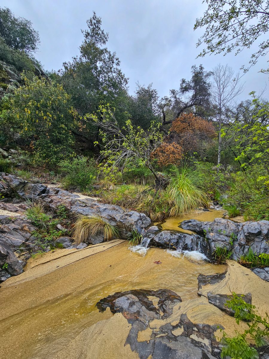
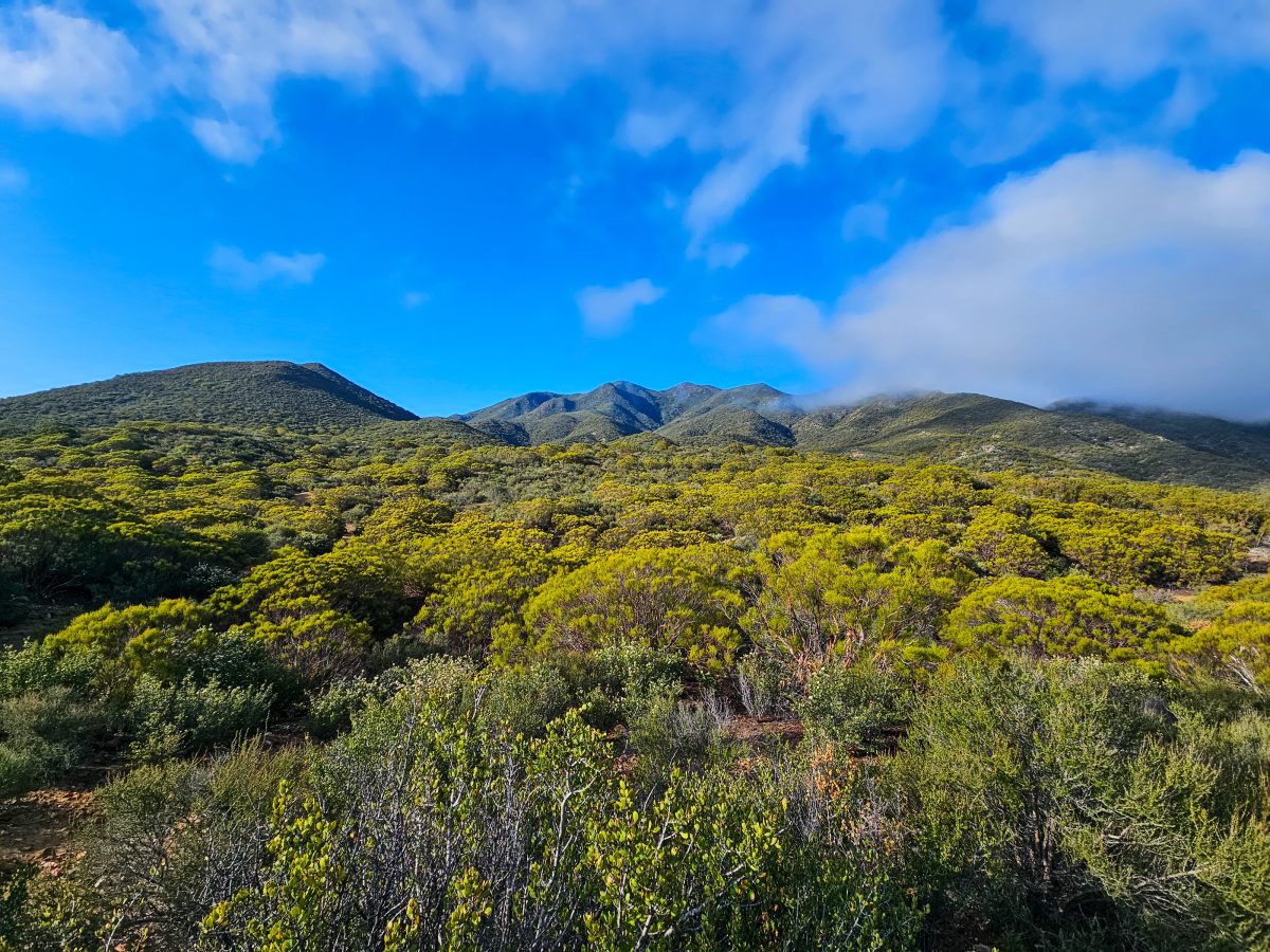
The trail then meandered uphill along the scenic Agua Caliente Creek for another hour or so. It was still very cloudy and a bit windy, but this section was so beautiful. It felt a bit like I was in Hawaii again, given how humid and lush it was.
I played leapfrog (when a hiker passes and then is passed by another hiker repeatedly throughout the day) with Asa and Traffic Cone, two hikers I’d met the night before at the community center, all the way up the creek. Traffic Cone, an older hiker from Florida, got his name from his younger hiking companion, Asa, because of the bright orange shirt and hat he adorned. The duo had previosuly hiked the Appalachian Trail together and were pushing consistent 20-25 mile days on the PCT. At this point, both of them insisted that my trail name was Kilometer. I’m still not super into that, as it doesn’t seem that creative or relevant to my hike, but oh well – maybe something better will present itself later on.
As I made my way up the mountain, I eventually got a mile or so ahead of the duo and ran into a few other hikers that I recognized from the community center. Around 5000ft, the clouds eventually cleared for a bit, but then suddenly got bigger and even darker. I pushed onward in hopes of getting water and setting up camp before it started raining again.
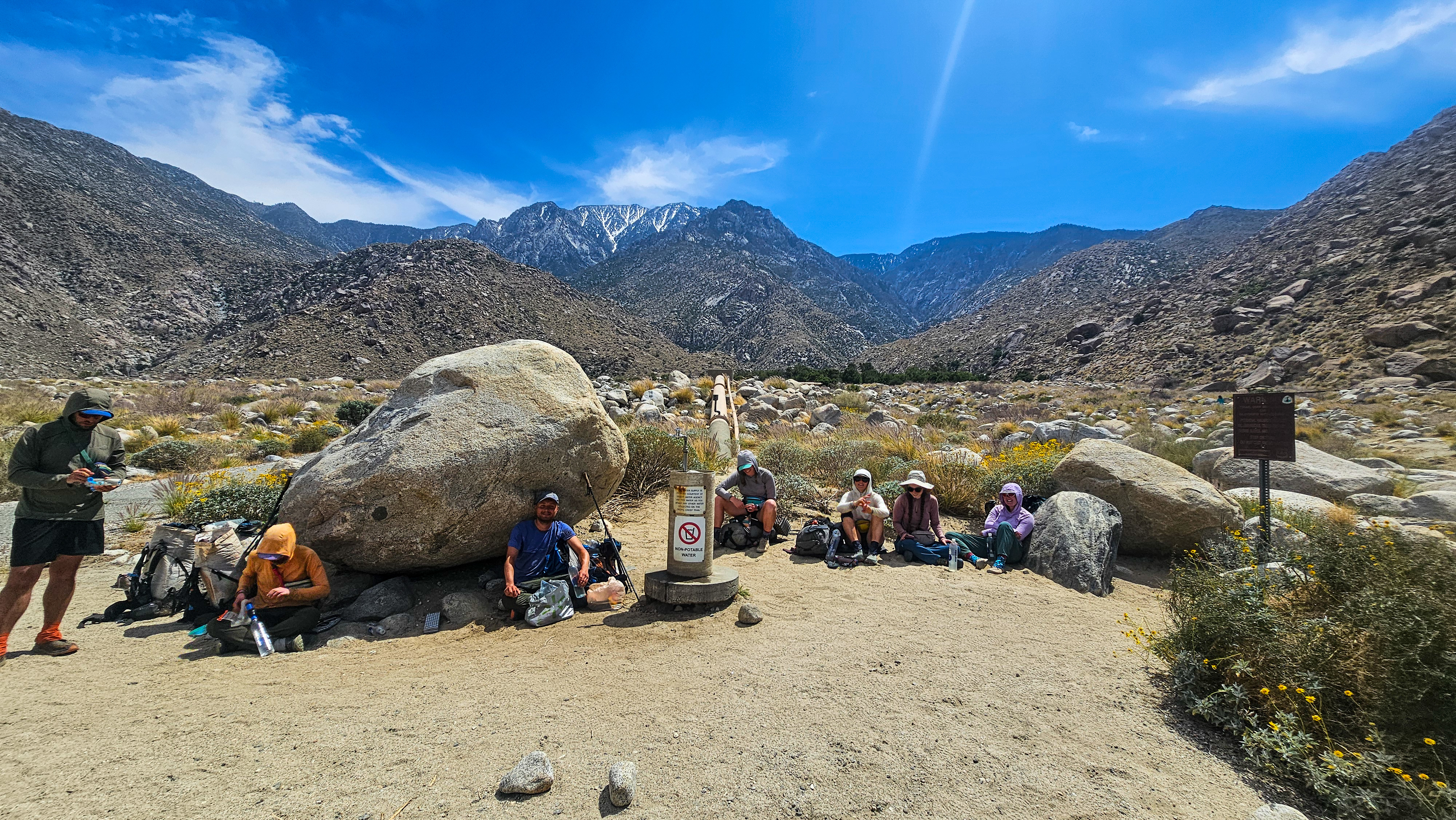
On the other side of the mountain, the trail was a lot less lush and a lot more reminiscent of hiking in the NM high desert. After about 18 miles, I got to the famed “Mikes Place” – the first water source since the creek and a historic hangout for PCT hikers. After hearing tales of the place, there was no way I wasn’t going to check it out now.
Mike’s Place was quite strange, to say the least. The walls of the garage and house were graffitied with PCT hikers’ signatures and drawings, and there was classic rock playing from a scratched CD (skipping every 10 seconds or so) and a trash fire burning in a fireplace standing in the middle of the yard, but seemingly no one was home. It turns out, Mike’s Place was just a dirty, dingy place with meth lab vibes. Maybe its hiker haven days were over? (Later in the week, I heard stories of Mike or a friend of his hosting hikers at the property and serving them questionable meals and making awkward advances at women)
After making my way back up to the water tank up the hill, a few more hikers showed up and declared they were staying at Mike’s for the night, but a young guy from Asheville and I decided to push on another 5 miles north. By this point, the weather started looking really bad, so we just wanted to get off the mountain and camp low. I ended up with almost 23 miles by the time I made camp. This was probably one of my strongest days on trail since day 1! The climbs were aplenty and the miles long, but my body felt great. Spending that half day at Warner Springs really did pay off. I also switched to wearing only liner toe socks (vs wearing liners AND wool socks) and had less issues with foot pain. Before bed, I tried to do some maintenance on some blisters I had gotten days before and they were not looking great. I’d need more bandages soon.


DAY 9
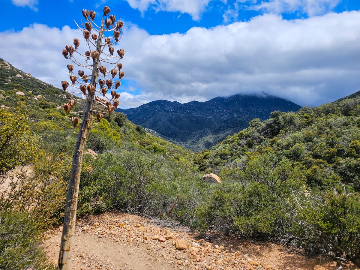
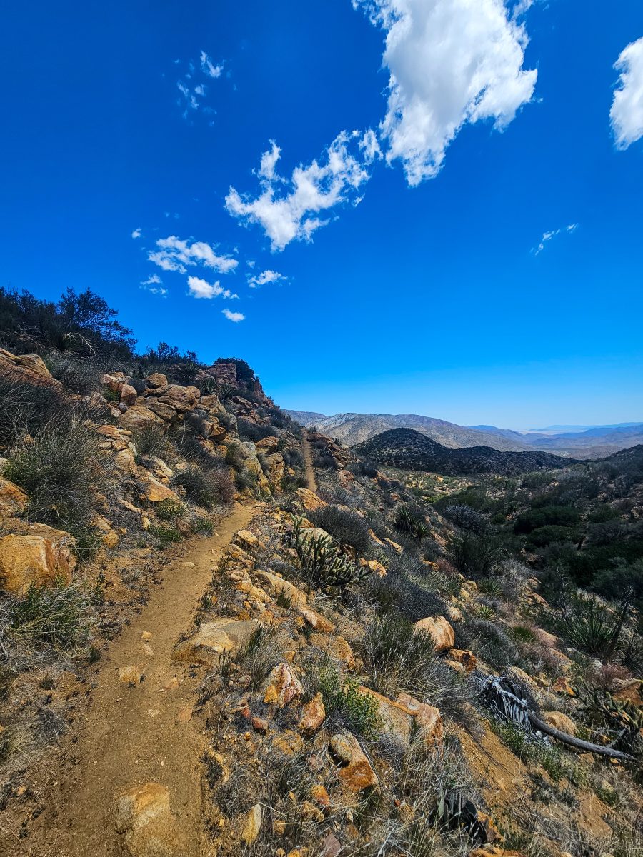
The sun finally came back out before breaking camp this morning- what a relief, at least until it got uncomfortably hot and exposed. As I was still climbing down from the previous day’s mountain, there was a good bit of downhill for pretty much the entire day. The desert views were great though – some of the best since the section before Scissors. Cacti and agave lined the trail, and lizards were once again seen basking in the sun around every corner.
I got off trail twice today for water and snack detours. As there were no natural water sources for the entire day’s hike, I had to rely on local trail angels for water. I played leapfrog again with Asa and Traffic Cone for pretty much the whole day. We hung out a while with a bigger group at one of the trail angel’s houses and got some fresh fruit and soda. It felt great to sit in the shade with my shoes off for a while, catching up with other hikers. Even a desert boy like myself needs to cool off and escape the sun for a bit.
I eventually lost the pack when I got off trail again to check out Little Bear Hostel, the second trail angel’s house. It was a fairly big detour off trail, but it was soo worth it for water, veggie dogs, shade and a surprise chance to hang out with a tiny kitten! He was all over me the second I sat down. I’ve never known a cat to voluntarily sit on my head. It was just way too cute and felt like my baby Cappy was ending me an angel – a very special moment I won’t soon forget.
I eventually got back on trail and tagged the hiker I met at Mike’s Place the day prior. We hiked 5 miles together to the famous Paradise Valley Cafe – a restaurant right off the trail that’s famous for feeding hungry hikers before they begin the climb up the San Jacinto Mountains. It turns out Ben and I have a bit of a connection in that we both lost a parent at a young age and we’re both hiking the trail in hopes of finding some closure and peace. We also realized that both of us carry the ashes of our deceased parent in small urn necklaces. Ben is very religious and plans to propose to his girlfriend after carrying an engagement ring all the way to Canada! He is a very sweet and very romantic young man.
By the time we got to the restaurant, I ended up logging 24.5 miles. Both of us were absolutely exhausted. Asa and Traffic Cone were already at PVC with two other hikers who’d gotten off trail due to a storm on San Jacinto that weekend. We all cowboy camped right on the porch of the restaurant – something I obviously never would have even considered doing if I were alone that evening. It was fairly warm under the awning, considering it was close to 30 degrees that night, but I got some pretty miserable sleep. Sleeping 100ft away from a highway next to a bunch of stinky hikers just wasn’t doing it for me. I prefer being in my tent up in the mountains.


Day 10
I woke up feeling extra homeless this morning. It must have had something to do with sleeping with a bunch of stinky hikers on the front porch of a diner. Go figure. We were all up at sunrise and gathered our things while we waited for the restaurant to open. Once the kitchen staff showed up and opened the doors for us, we all raced inside like we’d never eat again. Within another 10 minutes, another dozen or so hikers showed up.
Ben (who I started calling Bible Ben in my head, since he carries a bible in his pack) joined me for breakfast and we discussed strategies for the upcoming climb – where to camp, how much water to carry, etc. These kinds of discussion account for at least 90% of what hikers talk about on trail.
After breakfast, I ended up separating from everyone because, before leaving for San Diego, I mailed myself a resupply box to the restaurant that I now needed to unpack, organize, and cram into my food bag. After getting that situated, I hiked solo up into the San Jacintos for about 12 miles. This was a slow slog for me, as I was pretty damn tired from the absolute lack of sleep the night prior. The milkshake I had with breakfast wasn’t exactly helping either. Pushing 24 miles as I had the day prior was absolutely out of the question.
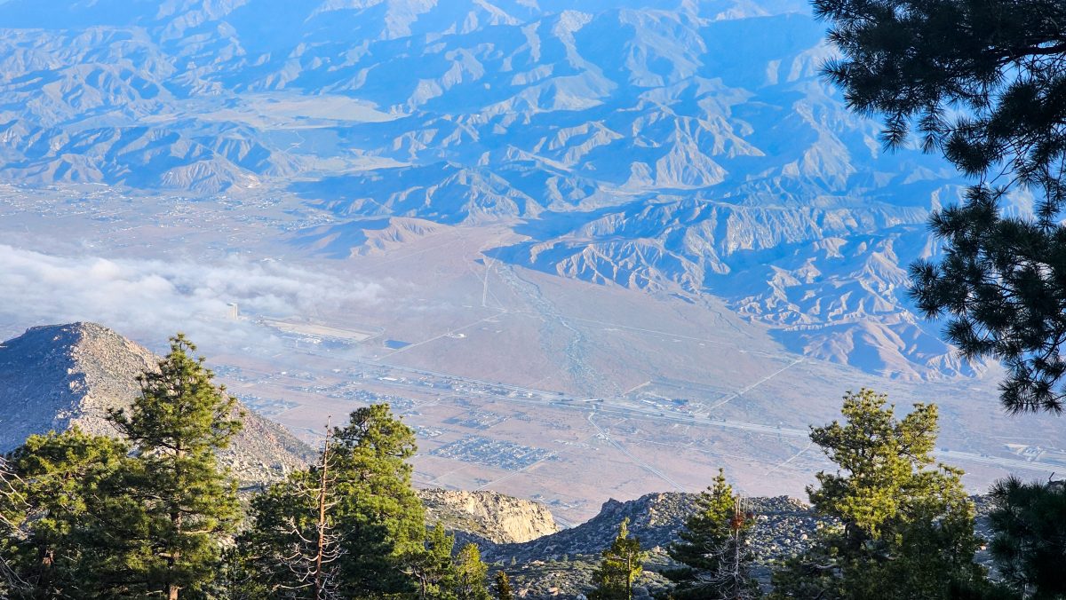
As I made my way up further into the mountains, I had some incredible views of Palm Springs and the whole Coachella Valley. The valley floor looked impossiblely far away already. Around 2pm or so, I caught up with everyone from breakfast at Cedar Spring junction, including Brandon, the hiker who let me borrow his phone the night I found out about Cappy’s passing.
Brandon was hiking with a Swiss guy named Cobbler and an English girl named Woody. Cobbler offered to grab water from the nearby spring for everyone, but he didn’t come back for almost an hour. I was worried he had some sort of accident, but I guess it was just a terrible hike down and back up and his filter was just too slow to keep up with getting water for four people. I ended up hiking with the three of them another 4 miles to camp.
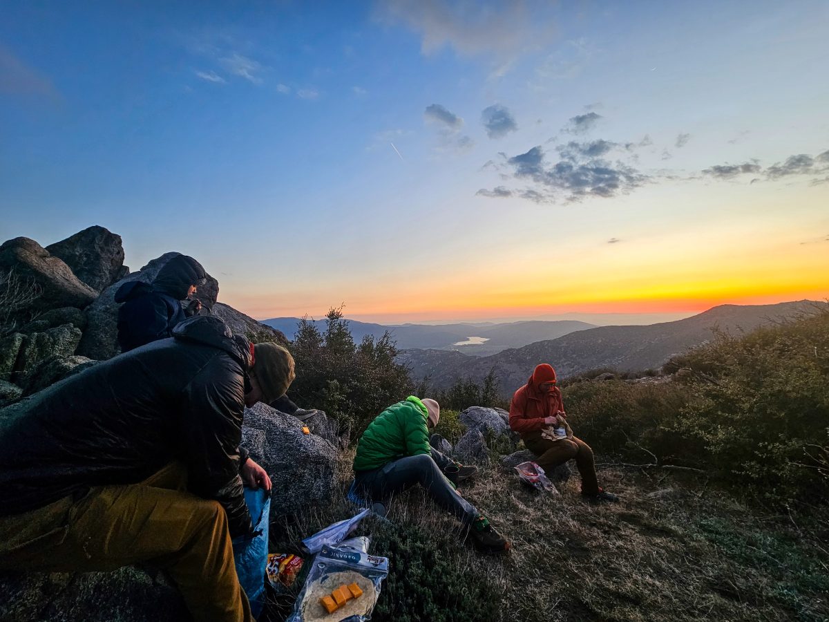
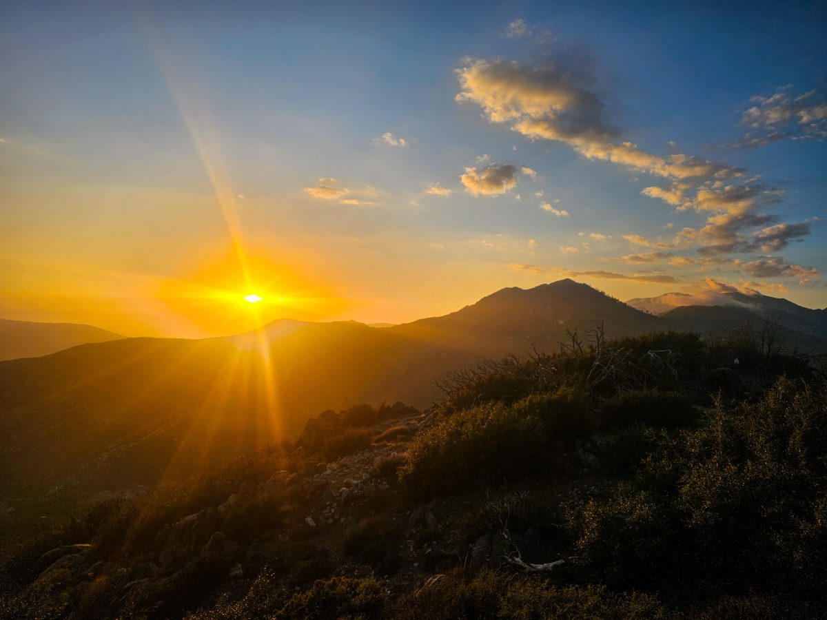
In the distance, clouds gathered around the summit of San Jacinto made it look like an erupting volcano. I got some of the best sunset pictures ever tonight and just had a really fun, genuine time. Maybe hiking with a group isnt so bad after all? Biped, another hiker that I’d been seeing for the past 4 days or so joined us for the final mile to camp and stayed with us that night. The five of us had dinner together and watched the rest of the sunset. With our eyes set on the long ridgeline leading up to the summit, we knew tomorrow’s hike was certainly not going to be an easy one, as the ridge has some pretty striking ups and downs before coming anywhere even close to the summit.


Day 11
Considering Brandon and crew had already been into town for their zero day (a zero-mile day – a day off, essentially), their plan was to push on today for the San Jacinto summit. Biped and I planned to drop into Idyllwild for a zero day, so we split from the rest of the group and left early to tackle the 15 miles to Saddle Junction, where a side trail would lead us into town.
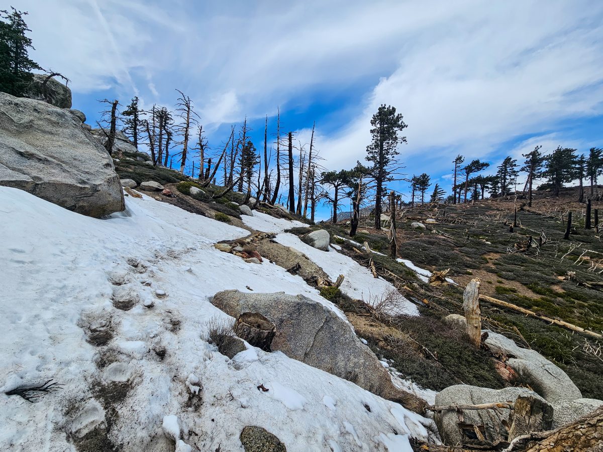
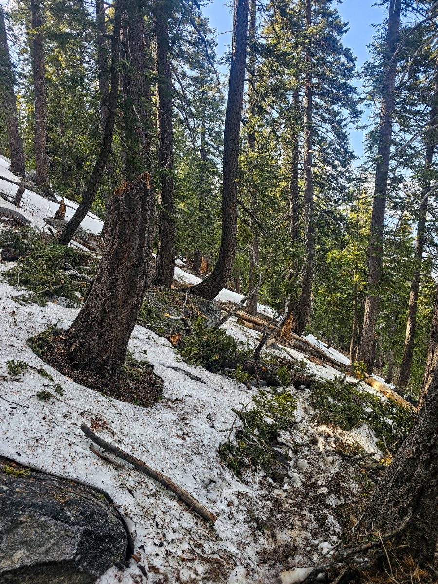
The hike turned out to be a lot more than we bargained for. Biped left a little before me and paced a mile or so ahead of me for most of the day, but we both struggled with foot pain and utter exhaustion. This was my slowest day yet, averaging around 30min/mile. I used my trekking poles for the first time as well. They had mostly just served as ornaments strapped to the back of my pack until now, but my broken body could not have handled today’s climbs without them. There were tons of enormous downed trees, some fairly significant exposure along narrow trail, and snow above 8k feet. It was a real struggle, for sure, but the views were unbelievable. The narrow ridge led the trail up and down, over and over again, with striking views of distant valley floors on both sides.
Biped and I finally reunited about 2 miles from Saddle Junction and hiked down the Devil’s Slide trail into Idyllwild together. This additional 2.7 miles and 2k ft of elevation loss was truly the cherry on top after such a grueling day, but it give us plenty of time to chat and get a little more acquainted. It turns out Biped is a cartographer, having worked both in Oregon and New Mexico, we had quite a bit to talk about! He is also very experienced outdoorsmen in general. The name Biped is both an homage to an old family saying, as well as a reminder for him to express gratitude for having two working legs – something that he won’t have forever, as medical complications may lead to amputation for him within the next decade.
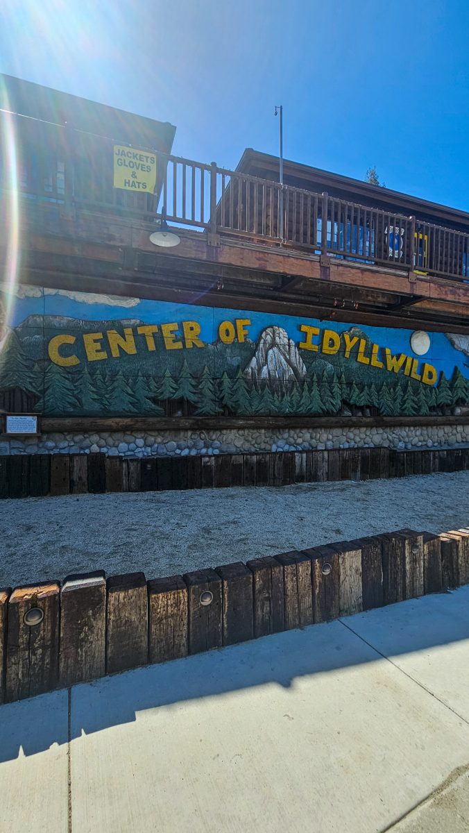
After descending, we were able to grab a pretty quick hitch into town from a local. Our first stop was grabbing ice cream at the grocery store, of course. We booked a room for two nights at the lodge and met Woody and Brandon for dinner at a nearby brewpub. Apparently, they couldn’t resist coming back into town for beer and burgers. I can’t say I’d voluntarily descend and ascend Devil’s slide for such a brief visit, but to each their own. Cobbler, the swiss hiker in their party, was still somewhere up on the mountain pushing through the snow.
Biped and I taking are taking a well deserved zero tomorrow and will head back up the mountain on Friday morning. My plan is simple – rest my feet, epsom soak in the tub, and get some extra medical supplies. It will be nice to just lay low, as im not trying to be super social. I know a lot of hikers use town days to party and socialize, but I’m ready to just chill on a real bed!


Day 12
Today was my first zero day in town. It was so refreshing sleeping in a bed and not rushing to get packed up and moving. I spent the day doing doing “town chores” – laundry, shopping, mailing postcards, cleaning and organzing gear, etc. I walked around town quite a bit, which is kind of funny considering we came into town to get a break from walking.
For lunch, I had a gaint smash burger and milkshake with Biped and his Dutch hiking friends. Afterward, we joined a bunch of other hikers and tourists, to meet the dog mayor. That’s right, Idyllwild has a dog mayor. (Who apparently hates all other dogs and does not hesitate to assert his authority)
Biped joined a group of hikers in the park for a BBQ and hangout, but I decided to stay in and have a bit of a spa night to myself. I enjoyed an epsom salt soak and a lazy evening in bed.


Day 13
We had a big, big climb today, to say the very least. Biped and I got up early and grabbed donuts at the local bakery. We each grabbed one extra donut for summit as well. A trail angel gave us and a few other PCT hikers a ride to the trailhead. By 8:30, we were headed up Devils Slide back towards Saddle Junction. Aftee getting back up to the point on trail we left off two days prior, we started to pushed up further towards the summit. We ascended an additional two thousand feet or so and made it up to the top by noon.
My body was feeling very well rested and mostly recovered. I didn’t pull my hiking poles out today, so I knew had my strength back. The ascent was long and there was a good bit of snow on ways up to summit, but it was nothing I hadn’t seen before.
On the way up, I had a brief reunion with Emma, Fruitloops, and Jess – the girls I split a cabin with on Day 5. I was so happy to see them! They were on their way down the summit to do a double zero in town, so the chances of hiking with them would be even less now.
Biped and I saw Traffic Cone, Asa and their hiking companions at the summit of San Jacinto at 10,787 ft, the highest point on the Desert Section of the PCT. Everyone was hanging out outside of the old summit shelter, which is apparently now a mouse haven, hantavirus and all. Yikes.
We had our summit donuts (oh so good) and hung out for a bit discussing plans about an upcoming storm. The group was pretty spooked about the possibility of snoe and wind along the next 50 mile portion of trail. Some had already decided to retreat tp a nearby town to ride it out.
Biped and I left the summit and started our descent. There was tons of snow under tree cover for the rest of the afternoon. The route finding was starting to get a little tricky, as the trail started to be less and less visible under snow and deadfall. At one point, we pushed through a solid 2 miles of slushy snow at a fairly steep angle. It was unnerving and made for some very slow moving, for sure. My feet were still feeling good, but the constant gains and losses were weighing on me a bit mentally.
We ended up finishing the day with 5k feet of elevation gain and 4k feet of elevation loss. I was ready to hit camp and eat dinner. When we got to Fuller Ridge to camp, another couple of groups were already set up. We had dinner with History, who I hadn’t seen since day 6 or so. It was great to catch up and hear about his experiences. The rest of the group showed up an hour or so later and we chatted and goofed off until sundown.


Day 14
Biped and I left camp by 7am today – my earliest start. We knew we had a big day ahead, so we wanted to get going. Fortunately for us, we didn’t encounter anymore snow, but the descent was intense, regardess. The trail switchbacked over and over again all day long.
As we dropped in elevation, the pine forest faded away and sweeping views of the desert below opened up. It was like looking down from a 14er. For a while, all we could see down there was the giant casino in Cabazon, but eventually we made out details of the highway and could see trucks and trains passing below.
We grabbed water at a small creek about 4 miles down, and packed enough to make it another 12 miles to the bottom of the mountain. The switchbacks continued as we dropped down to the base of the mountain, the trail now lined with beautiful desert flora once again. On the way down, we passed the 200 mile marker – I’d now finished a whopping 7.5% of the Pacific Crest Trail! Only 2,543 miles to go!
16 miles later, we had dropped over 7,000 feet in elevation (the biggest elevation drop on the entire PCT!!) and were now gathered with a large group of hikers at a water faucet at the base of San Jacinto. Biped and I “cameled up” and queried the rest of the group on their plans to weather the upcoming storm. Most planned to hide out in town. Biped and I decided to push to the interstate and then make decisions.
After 4 miles of desert wandering through some absolutely brutal wind, we crossed under the railroad and i8. A friend of mine who was visiting family in nearby Yucca Valley picked us up and took us to In N’ Out in Cabazon. I can’t even keep track of how many cheeseburgers I’ve had on this hike so far. My friend and I dropped Biped off at a hotel, as the wind we had just weathered on the push from the mountain drove us into deciding that camping nearby was not going to be an option afterall.
I spent the rest of the night feasting and monitoring the weather, still unsure of how to proceed with the approaching storm. The 50 miles of trail leading to the town of Big Bear Lake are apparently already pretty demanding without wind and rain, so we’d need a solid plan to make it safely through that section.


WEEK 2 TOTALS
Miles Hiked: 114.3 miles
Elevation Gain: 21,167ft

